(Leaflet – Hutton Lowcross Heritage Trail)
A journey through Victorian railways, woodland and hidden history.
Overview
- Start point: Pinchinthorpe Branchwalk Way Visitor Centre
- Distance: 1.85 Km
- Approximate time: minimum 35 minutes
- Terrain: mostly flat route along wide accessible paths through wooded area and along the old railway line
- Accessibility notes: this route follows the new accessible trail created by Forestry England. Some woodland sections have very minor easy inclines.
- End point: Visitor Centre
This trail has been researched and written by the Guisborough Community Heritage Group to help visitors discover the hidden history of the woodland landscape.
This walk is much more than a route through the forest.
It is a journey through Victorian railways, estate life, woodland management and traces of an even older landscape.
Along the way you’ll discover places that are easy to pass without noticing. Take your time, look closely and enjoy uncovering the hidden stories of Guisborough Forest.
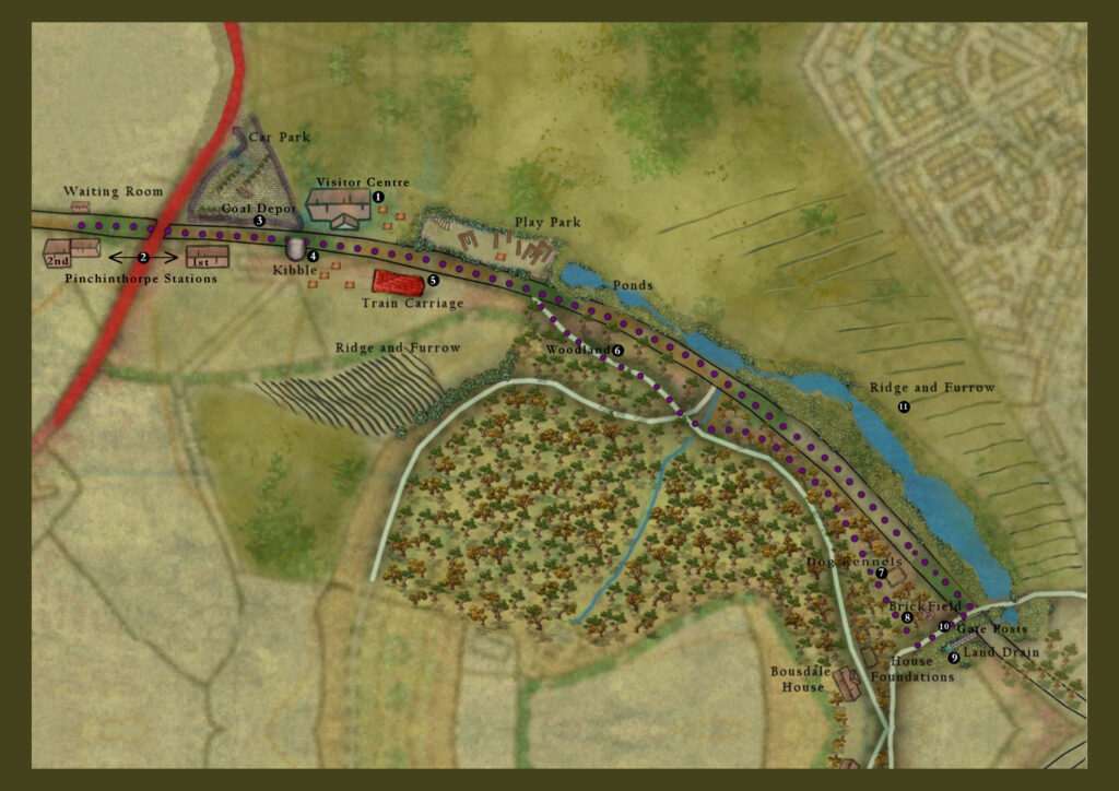
The numbered points correspond to locations in the text below
Chapter 1
🚂 The Railway Years
🚶 Route directions…
Start at the Visitor Centre (1)
From the Visitor Centre, head west along the railway walkway towards Nunthorpe. (Note, in order to see the Railway Stations you have to walk in the opposite direction from the purple Harrison Close Trail signs to start with)
🏛️Pinchinthorpe Railway Stations (1 & 2)
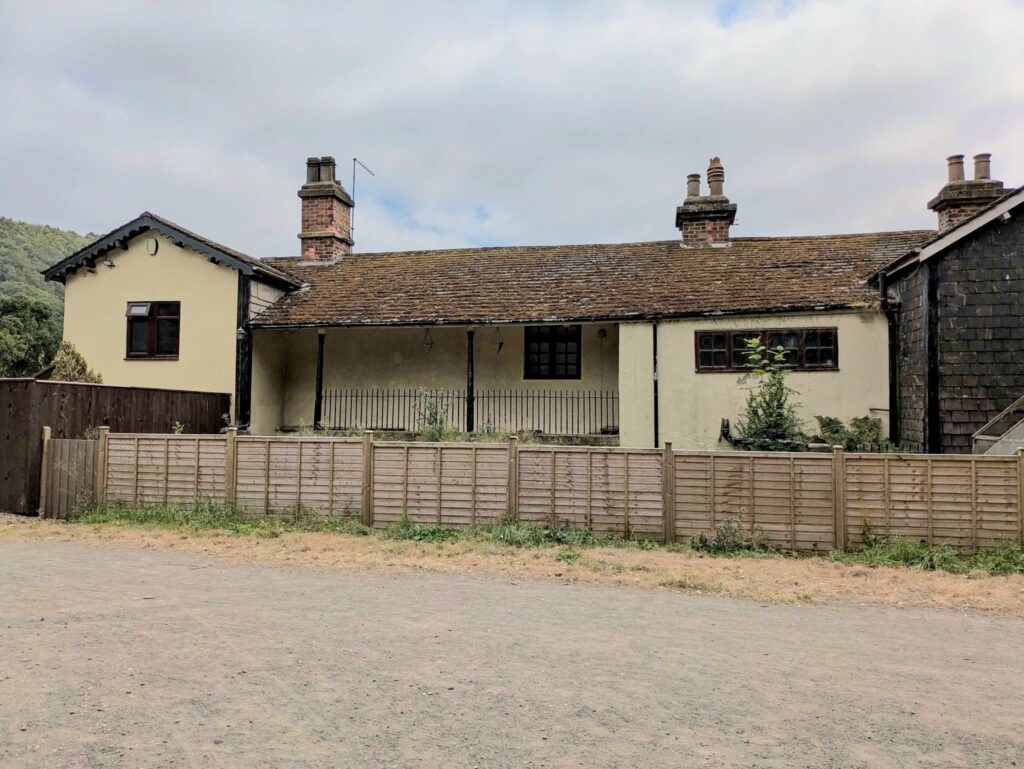
On your left stands the first Pinchinthorpe Railway Station, opened in 1854. When the level crossing was replaced by a road bridge in the 1870s, the station closed and a larger replacement was built on the opposite side of the bridge.
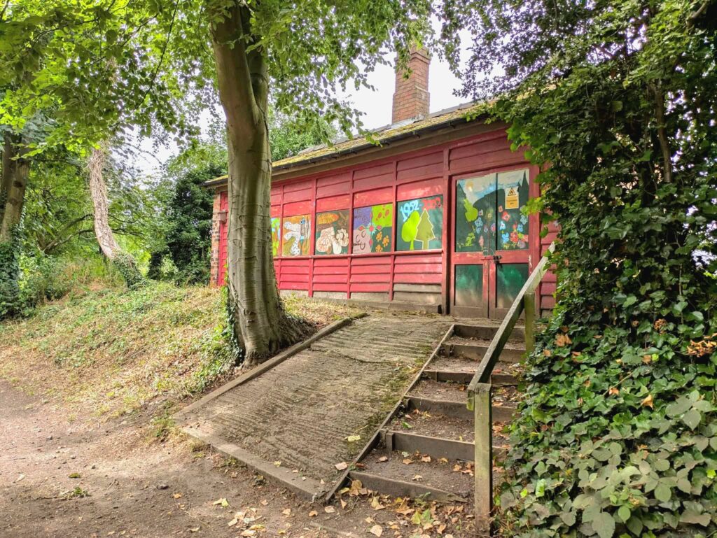
Continue beneath the road bridge and you’ll pass the second station, now a private house.. On the right is the former waiting room, today used by the countryside wardens.
📜 Did you know?
Both stations were officially spelt Pinchingthorpe until the 1920s.
📖 Discover more:
Pinchinthorpe Railway Station.
🚶 Next…
Retrace your steps towards the Visitor Centre.
🏛️Coal Depot (3)
Just before reaching the Visitor Centre, look left into the car park. The sandstone wall beside the disabled parking bays once formed part of the coal depot, where coal wagons were unloaded.
👀 Look out for:
The dressed sandstone blocks that survive from the original structure.
🚶 Next…
🏛️Codhill Kibble (4)
Continue along the main path.
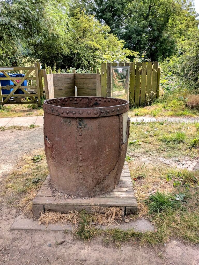
On your right you’ll see a large, bucket-shaped container known as the Codhill Kibble. Take a moment to read the nearby information board to learn more about its history.
Further along, look to your right for the 1960s railway carriage, known locally as The Train Carriage (5). It now serves as an education centre and meeting place — more details are on its information board.
🤔 Pause and Imagine…
How different would this quiet woodland have sounded when steam trains passed through every day?
🚶 Continue…
Follow the Harrison Close Route markers into the trees, opposite the second entrance to the play park (before the ponds). This path runs parallel to the railway walkway.
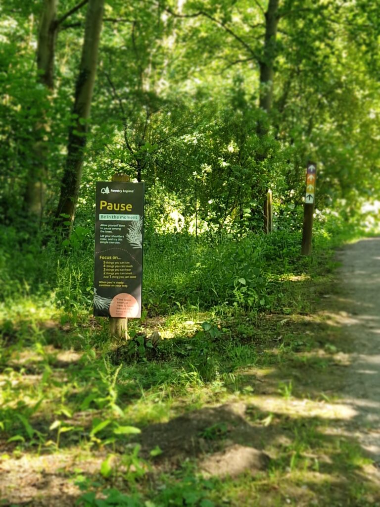
Entering the woodland. As you leave the railway behind and follow the Harrison Close Trail into the trees, the atmosphere begins to change. This is a good place to slow down, look closely and start noticing the landscape around you.
Chapter 2
🌲 Reading the Woodland (6)
Today’s woodland is very different from the one Victorian visitors would have known. Forestry practices, natural regeneration and changing priorities have all helped shape the landscape you see today.
👣 Pause a Moment
Close your eyes.
Can you hear birdsong?
Now imagine replacing it with the sound of steam engines, horses, carts and miners travelling through the valley.
🚶 Next…
At the crossroads just beyond the picnic table, continue straight ahead and then veer left back into the trees.
If you’d prefer a shorter walk, turn left, and left again to rejoin the railway line path then return to the Visitor Centre.
📜 Woodland Today
The Forestry Commission (now Forestry England) has managed Guisborough Forest for many decades, mainly growing pine trees for timber and paper. After felling, the land can look bare and harsh — but nature quickly bounces back, with ferns, wildflowers, and new saplings soon appearing. Birds drop seeds, insects find new homes, and the woodland regenerates.
Today, Forestry England is planting more indigenous trees, helping the forest return to a natural, mixed woodland for future generations to enjoy.
👀 Look out for…
- Tree graffiti – please don’t add your own!
- Native trees.
- Birdsong.
- Different ages of woodland.
As you wander, take a moment to pause and listen to the wind in the trees. Imagine what this area might have looked and sounded like during the height of the mining and railway activity in the 1800s.
🤔 Pause and Think…
If this woodland could speak, what stories do you think it would tell?
Chapter 3
🏡 The Victorian Estate
🏛️Small Sandstone Structure (7)
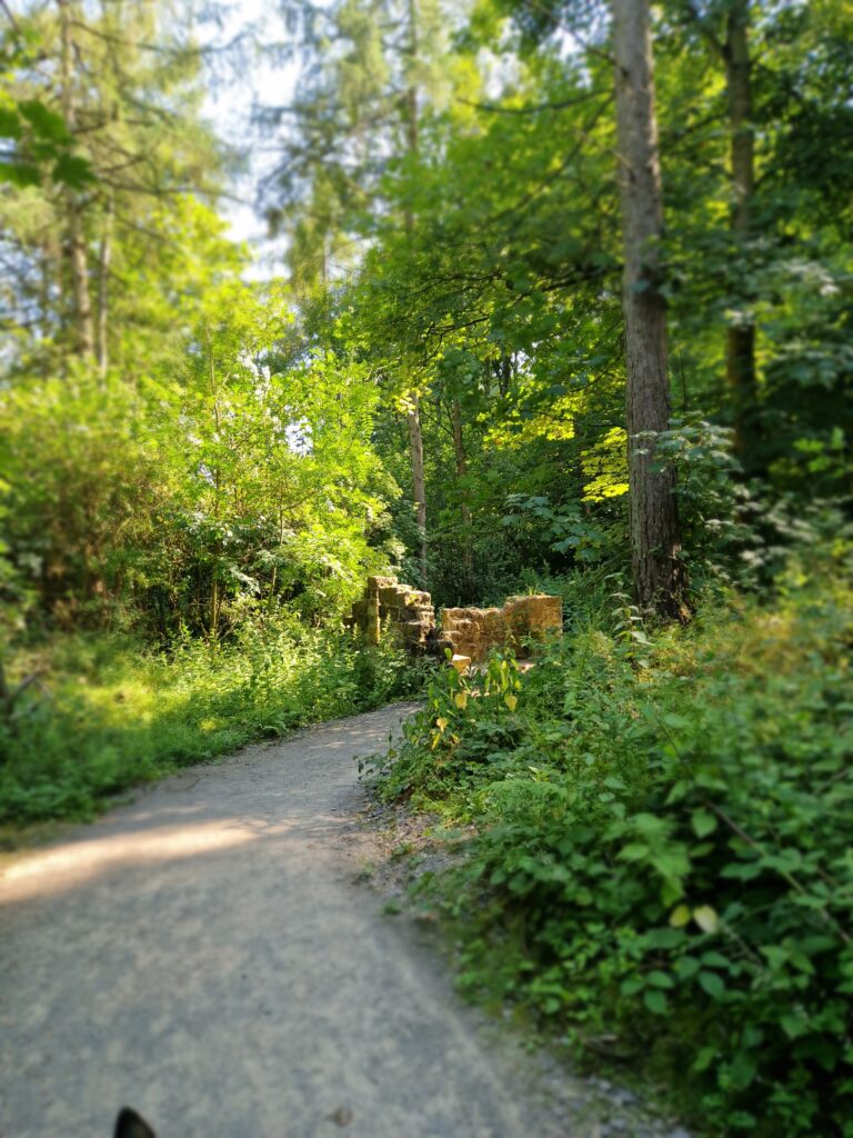
Next along the path stands a small sandstone structure — the possible remains of a Victorian Dog Kennel. What you see today is a reconstruction created by a group of Young Rangers during the 1980s.
Slightly beyond this point, on your right through the trees, there was once a pheasantry (1 of many) cared for by the gamekeeper who lived in the cottage further up the bank — you might just glimpse the cottage through the trees.
📖 Discover more:
The Victorian Gamekeeper
🤔 Pause and Think…
What jobs would have been carried out here 150 years ago?
Chapter 4
⛏ Industry and Farming
🏛️Brick Depot (8)
🚶 Next…
At the end of the path, turn left, downhill. Look to your left through the undergrowth — you may spot traces of a brick storage area. These bricks were made by the Pease family brickworks. They were likely used to build miners’ cottages and other local buildings connected to ironstone, alum, and jet mining in the mid to late 1800s. There is also a possibility that there was an earlier brick field here.
📜 Did you know?
Historical maps show there was a brickfield here in 1853 – before the Victorian Gamekeeping activities!
The distinctive Pease Bricks were manufactured further north and delivered here. You can still seen them in many buildings around the local area, especially in Saltburn.
📖 Discover more:
Pease Bricks
🏛️Land Drain (9)
On the right-hand side of the path you’ll notice a man-made land drain, best seen in winter when the vegetation is low. It channels spring water underneath the railway line and into a small pond.
🏛️Animal Creep (10)
As you pass through the stone gateposts —thought to have been a level crossing used by farmers moving cattle from the high pastures of Bousdale Hill to the cattle market in Guisborough
👀 Look out for…
Nearby, a small tunnel or “animal creep” allowed smaller livestock to pass under the railway. Once out of the tunnel the path turned left and went to Lowcross Farm or up Grove Hill towards Guisborough.
🚶 Continue…
🏛️Ridge & Furrow (11)
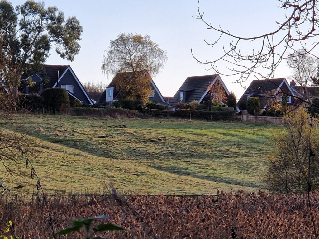
As you turn left towards the Visitor Centre, look across the fields on your right.
You can still see the marks from mediaeval ridge and furrow farming — these are best seen when the sun is low, or with a light dusting of snow or frost.
Old maps show that the watercourse ran from the small pond in a straight line (possibly man-made) to join up with the small beck coming down from Bousdale Hill. This area has been dug out over many years to create the larger pond you see today. These ponds are now home to a wide variety of wild life – ducks, herons, newts, toads, and frogs etc.
📖 Discover more:
Ridge and Furrow
🚶 Continue…
As you walk back, take a few moments to enjoy the information boards.
Question to ponder…
Can you still recognise the marks left behind by people who lived and worked here centuries ago?
🌿 Before you leave…
How many did you discover?
☐ Two former railway stations
☐ Coal depot
☐ Codhill Kibble
☐ Railway carriage
☐ Tree graffiti
☐ Victorian Dog Kennel
☐ White Pease bricks
☐ Animal creep
☐ Medieval ridge and furrow
Thank you for taking the Harrison Close Heritage & Accessibility Trail.
We hope you’ve discovered something new, connected with nature and found a little moment of peace in Guisborough Forest.
We’d love to hear what you discovered on your walk.
Practical information
- Please wear suitable footwear
- Paths may be muddy in wet weather
- Take care on uneven ground
- Dogs should be kept under control
Related routes
You can explore our other walking routes from the Walking Routes page.
Get involved
If you have information, memories or research related to this route, we’d love to hear from you.
Please visit the Get Involved / Contact page to find out how to contribute.